Rapid Response
Illegal mining threatens Indigenous land and lives in the Brazilian Amazon
Imaging for accountability
High-resolution satellite imagery can be used to verify reports of illegal mining in remote areas before limited regional resources are used for aerial surveillance or on-the-ground surveys. Continue scrolling to see the story told by images of the Yanomami Indigenous District that Maxar has already captured.
Encroachment on protected lands
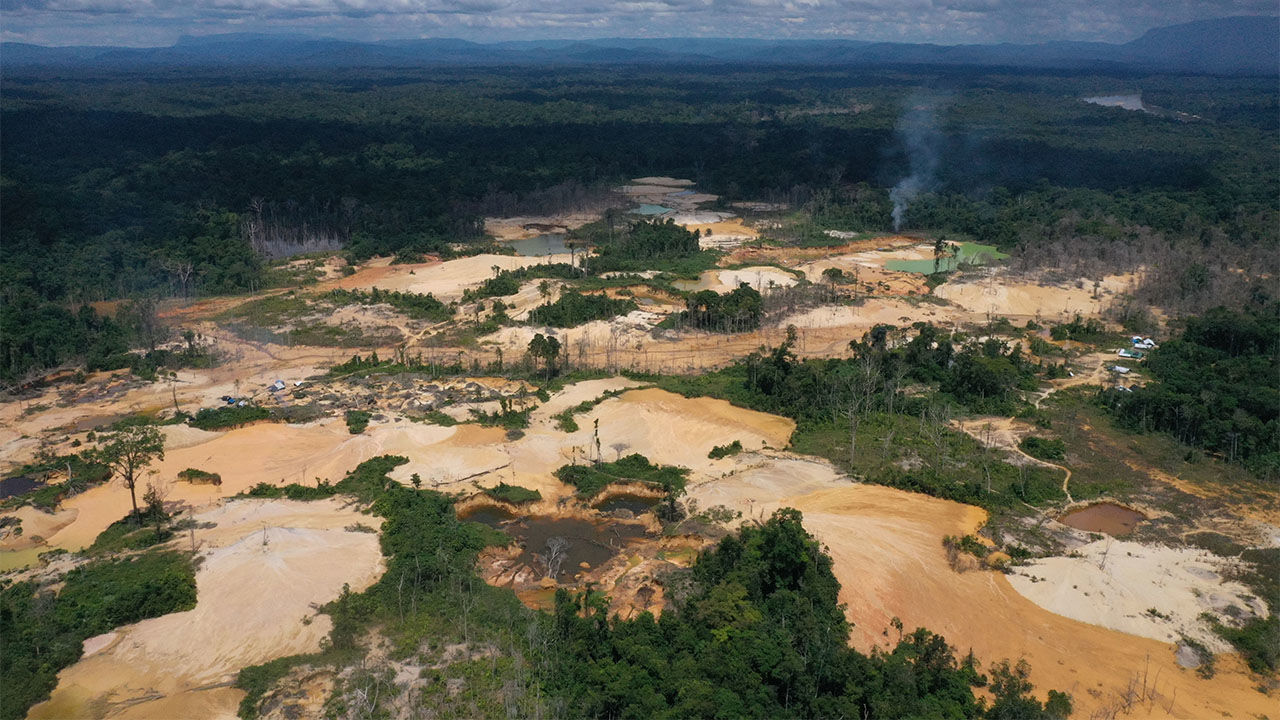
The Yanomami Indigenous District is a protected area of the Amazon rainforest in the Brazilian state of Roraima. Illegal mining and logging have caused the deforestation of more than 2,000 hectares within the District.
Explore the impact of illegal mining in the Yanomami Indigenous District
Use hover on the image to explore one of the many illegal mining operations active within protected Yanomami land. The high resolution of our WorldView satellites makes large-scale observation and documentation of this environmental and humanitarian crisis possible.
Combine satellite access with actionable analytics
Rapid Access Program
Virtual control of the full Maxar constellation through priority tasking, predictable access and imaging operations with a simple and affordable web interface.
Learn more

Fighting deforestation
Explore how Maxar’s combined offerings can be used to fight back against deforestation.
Learn moreREQUEST A DEMO
Dive into the details of this unique program and see how our simplified user interface can expedite access to critical intelligence.